![]()
Page Menu


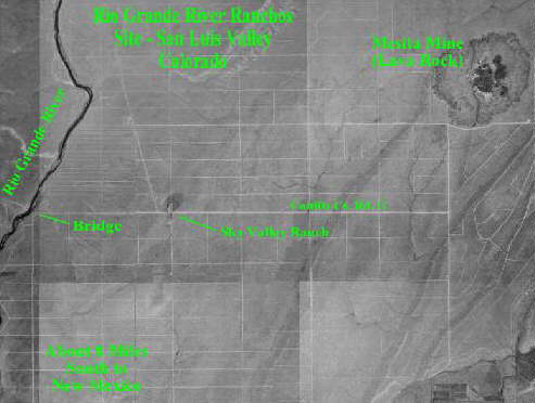
Satellite Image
Area West of Mesita, Colorado
|
Above is an aerial image of the UFO observation area between the Rio Grande River (which can be seen along the left side of the image) and the Mesita Mine (in the upper right of the image) which is an old volcano. The Town of Mesita is a very small ghostly town which is just to the East of the image above. The Town of Mesita once was along Colorado's loneliest railroad, the San Luis Southern Railway (find more information on the Mesita page). Some reports have come from this area. The subdivision road pattern is clear and since this image was taken, there has been some minor development in the area. West of the Rio Grande River is BLM land which will remain undeveloped. |
View more gifts at Zazzle.
![]()